Understanding our Parish Emissions
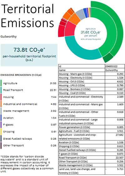
The Impact Tool has been developed to help parishes better understand their emissionsand indicate areas which could be considered to be priorities. The tool enables a parish to look at its Territorial Emissions and Consumption Emissions and these can be compared against other parishes.A look at the Territorial Emissions for the parish of Gulworthy showed a 73.8t CO2e per household territorial footprint (p.a) with agriculture making up 42% of the total footprint. Co2e stands for 'carbon dioxide equivalent' and is a standard unit of measurement in carbon accounting. It expresses the impact of a number of different gases collectively as a common unit.
To view the Territorial Emissions for Gulworthy Parish per household for yourself, follow the link below.